


Mert Ünal
2023 Spring
BS723 | Machine Learning Applications in Architecture
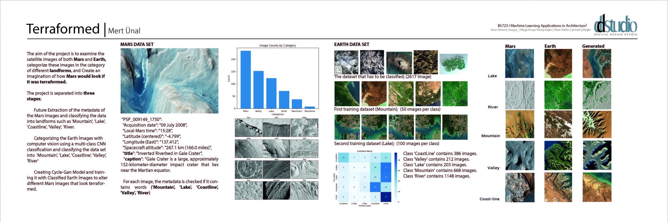
The aim of the project is to examine the satellite images of both Mars and Earth, categorize these images in the category of different landforms, and Create an Imagination of how Mars would look if it was terraformed. The project is separated into three stages; Future Extraction of the metadata of the Mars images and classifying the data into landforms such as ‘Mountain’, ‘Lake’, ‘Coastline’, ‘Valley’, ‘River. Categorizing the Earth Images with computer vision using a multi-class CNN classification and classifying the data set into ‘Mountain’, ‘Lake’, ‘Coastline’, ‘Valley’, ‘River’ Creating Cycle-Gan Model and training it with Classified Earth İmages to alter different Mars images that look terraformed.